https://youtu.be/C9LqVO2DNto
Navigeeri käed vabad, valides Foretrex 601 või Foretrex 701 ja AB Elite -programm. Need GPS-randmeseadmed vastavad sõjaväestandarditele.Tänu GPS-, GLONASS- ja Galileo-satelliidi süsteemile tead oma asukohta pea kõikjal maailmas.
Foretrex 601- ja 701-seadmed on vastupidavad temperatuuri kõikumistele,löökidele ja veeoludele.Seadmed vastavad sõjaväestandarditelele (MIL-STD-810G). Samuti on neil taktikalisi omadusi:nt.toetavad öövaatlusseadmeid ja Jumpmaster-programmi.
Foretrex 601 and 701 navigators are beyond durable. They’re built to military standards for thermal, shock and water performance (MIL-STD-810G). They also include tactical features such as compatibility with night vision goggles and Jumpmaster mode.
Foretrex 601- ja 701-seadmed kasutavad kolme satelliitt navigeerimise võrku: GPS, GLONASS ja Galileo. See aitab täpsemini määrata asukohta kui ainult GPS. Kasutus aeg on tavalisest pikem kuna aku kestab navi olekus kuni 48 tundi ja 1 nädal UltraTrac-olekus.
Both Foretrex 601 and 701 work with 3 satellite navigation reception networks, including GPS, GLONASS and Galileo, to track your position in more challenging environments better than GPS alone. Explore longer — battery life exceeds 48 hours in navigation mode and lasts up to 1 week in UltraTrac mode.
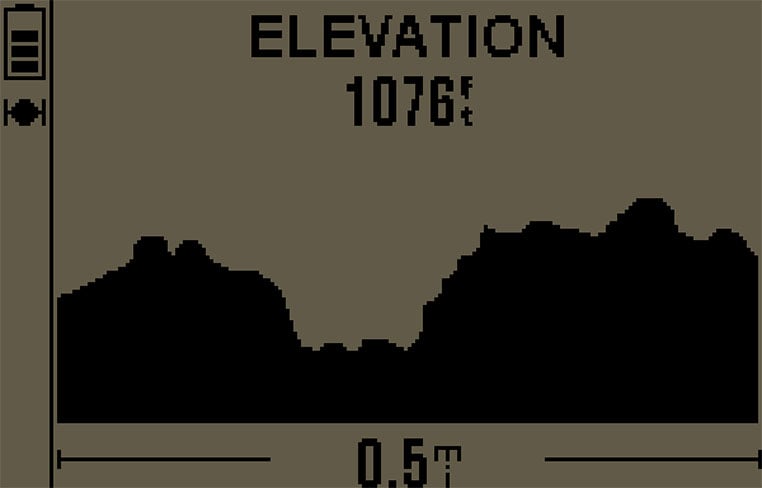
Foretrex 601 ja 701 kasutavad GPS andurit,kõrgusmõõtjat,baromeetrit ja kompassi millega juhatavad sind pea kõikjal maailmas.Tänu kõrgusmõõtja andmetele on tõusude ja laskumiste jälgimine täpne. Baromeetri abil võib ennustada ilma õhurõhu muutumise järgi lühikeste ajahetkede vahel.Kolmeteljeline elektrooniline kompass näitab suunda sõltumata sellest kas seisad või liigud.
To guide you on and off the beaten path, Foretrex 601 and 701 provide comprehensive navigation and tracking using GPS plus ABC (altimeter, barometer and compass) sensor capabilities. The built-in altimeter provides elevation data to accurately monitor ascent and descent, while the barometer can be used to predict weather changes by showing short-term trends in air pressure. The 3-axis electronic compass keeps your bearings, whether you’re moving or not.
Seadametes kasutatavate nutiteavituste1 abil võid vastu võtta e-posti ja tekstisõnumeid,samuti hoiatusi otse telefonist randmeseadmesse. Võid käivitada Garmin Connect Mobile - abil LiveTrack1-toimingu,et teised saaksid jälgida su rännakut mobiilivõrgus. Lisavõimalusena saad automaatselt ühineda Garmin Connect™ -treeningu keskkonnaga ja automaatsed tarkvara uuendused kui seade on mobiiliga ühendatud.
Smart notifications1 — available on both devices — let you receive emails, texts and alerts from your mobile device right on your wrist. Use the Garmin Connect Mobile app to initiate the LiveTrack1 feature to allow others to follow your journey (within cellular coverage). Other connected features include automatic uploads to our Garmin Connect™ online fitness community and automatic software updates when paired to a mobile device.
1When paired with a compatible smartphone.
| General | |
| Physical dimensions | 7.3 x 4.3 x 2.2 cm |
| Weight | 87.8 g with batteries |
| Water rating | IPX7 |
| Battery | 2 AAA batteries (not included) |
| Display type | High-resolution 4-colour grey |
| Display size | 2.0" diagonal |
| Display resolution | 200 x 128 pixels |
| Battery life | Exceeds 48 hours in GPS mode; up to 1 week in UltraTrac mode; up to 1 month in watch mode |
| Interface | USB |
| Maps & Memory | |
| Basemap | Yes |
| Waypoints/favorites/locations | 500 |
| Routes | 20 |
| Track log | 10 |
| Sensors | |
| Barometric altimeter | Yes |
| Compass | Yes |
| Outdoor Recreation Features | |
| Area calculation | Yes |
| Hunt/fish calendar | Yes |
| Sun and moon information | Yes |
| Garmin Connect | |
| Garmin Connect compatible (online community where you analyse, categorise and share data) | Yes |
| Additional | |
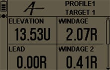
| Additional | Applied Ballistics Elite |
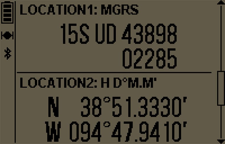
| Dual grid coordinates: customisable | |
| MIL-STD-810 Compliant: thermal, shock, water | |
| Night vision goggles compatible | |
| Audible tones | |
| GPS antenna type: patch | |
| GPS/GLONASS/Galileo support | |
| Saved tracks: 100/200 points per track | |
| Clock features: time/date, watch mode, military time format, GPS time sync, automatic daylight saving time, alarm clock, timer, stopwatch, sunrise/sunset times | |
| Customisable data pages | |
| Touch and/or button lock | |
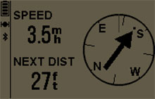
| GPS speed and distance | |
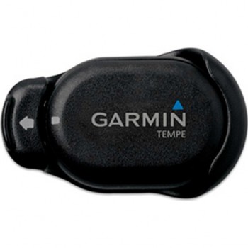
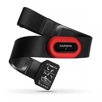
| Sensor compatibility: HR strap, speed, cadence, VIRB®, tempe | |
| GPS-based distance, time and pace | |
| Jumpmaster | |
| Point-to-point navigation | |
| Bread crumb trail in real time | |
| Back to start | |
| TracBack® | |
| Elevation profile | |
| Distance to destination | |
| Barometric trend indicator | |
| Vertical speed | |
| Total ascent/descent | |
| Unit-to-unit route/location sharing | |
| GPS coordinates | |
| Projected waypoint | |
| Sight 'N Go | |
| Smart notifications | |
| LiveTrack | |