

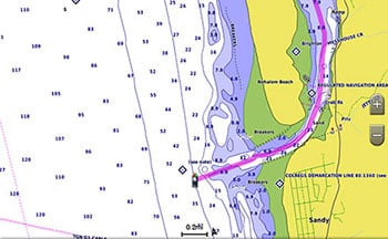
BlueChart g3 coastal charts provide industry-leading coverage, clarity and detail with integrated Garmin and Navionics data. Also included is Auto Guidance1 technology, which uses your desired depth and overhead clearance to calculate routes and provide a suggested path to follow — overlaid onto your chart. NOAA raster cartography is also available as a free downloadable feature via the ActiveCaptain app. It gives your chartplotter paper chartlike views of NOAA-surveyed areas in which individual points of interest are labelled with corresponding longitude and latitude information. Worldwide coverage is available by regions as accessory cards or via download; each region is sold separately.
The Auto Guidance feature1 calculates a suggested route using your desired depth and overhead clearance.
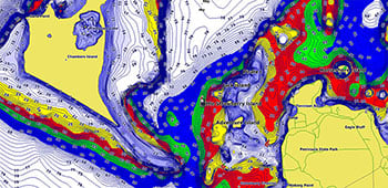
This feature displays high-resolution Depth Range Shading for up to 10 depth ranges, so you can view your designated target depth.
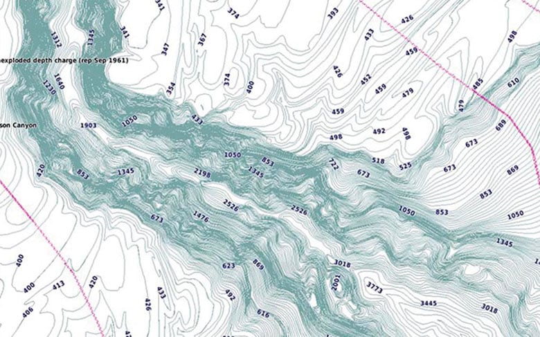
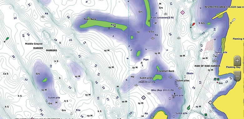
BlueChart g3 charts feature 1-foot contours that provide a more accurate depiction of bottom structure for improved fishing charts and enhanced detail in swamps, canals and port plans.
To aid in navigation, Shallow Water Shading allows map shading at a user-defined depth to give a clear picture of shallow waters to avoid.
1 Auto Guidance is for planning purposes only and does not replace safe navigation operations. Auto Guidance is not included in preloaded BlueChart g3 for ECHOMAP™ Plus series chartplotters

check_circle
check_circle